


Misinformation in Media
More


![]()
Rumours travel fast, especially online, but when information is inaccurate or taken out of context, it can lead to misunderstanding. We are aware of some misinformation circulating on community social media regarding public maps, development, and community events. Below, we’ve outlined the key facts to help set the record straight:
Community Events
We understand this will be a challenging year with the construction in Shedden and Fingal. The Township is not cancelling any community events and is committed to working with local groups to accommodate their events.
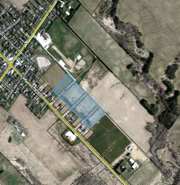
Recent Zoning By-Law Amendment
Image 1 shows the area sold is the blue-highlighted area and does not include any land from the Keystone Complex property or the Corsley Park property.
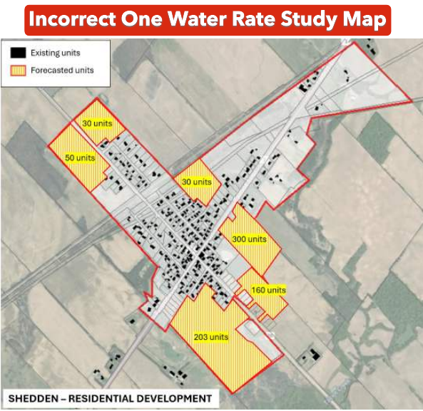
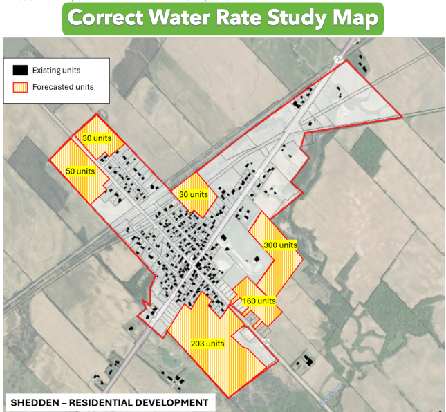
Water Rate Study
During the review period of the final One Water Rate Study report, an error was identified in the mapping for the Shedden Development Area (see Image 2). This issue was flagged to the consultant, and the map was corrected and the updated report posted to the Township website.
Due to a technical issue, the previous version of the report containing the incorrect map remained accessible until today, even after the corrected version had been uploaded. We apologize for any confusion this may have caused and will be following up with our website provider to ensure this does not occur again.
It is important to keep context in mind when reviewing these documents. A water rate study uses a variety of mapping and planning information to inform infrastructure needs and financial calculations. However, it is not the authoritative planning instrument for development activity. As a result, minor discrepancies may occasionally appear between supporting studies and formal planning documents.
Residents looking to understand where development is planned should refer to the Township’s Official Plan and Zoning By-Law, which are the authoritative planning documents.
Please refer to the correct One Water Rate Study: https://www.southwold.ca/en/municipal-office/resources/Studies/23-2074_OneWaterRateStudy_250225V2.pdf
This study can be found on our website under Municipal Office, on the “Plans, Reports, Studies, and Projects” page. The map can be found on page 37 of the study.
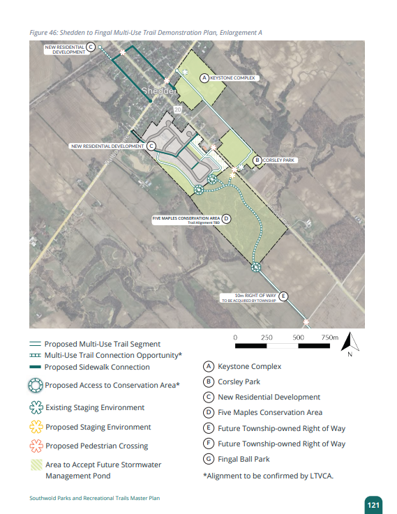
Parks and Trails Master Plan
To further affirm the Township’s commitment to keeping all of its parks and facilities (yes, that includes the Keystone Complex) as public spaces, the Parks and Recreational Trails Master Plan is on Council’s agenda for adoption tonight. The plan protects the parks and spaces we enjoy today while mapping out future improvements, ensuring they remain flexible, welcoming places for community events, recreation, and everyday enjoyment for years to come.
So before jumping into the comments section or sharing something questionable, reach out to us first. We’re always happy to help, provide the right information, and correct an error if one slips through. It happens — we’re human too.
If you have any questions or concerns, now or in the future, please contact the Township Office at 519-769-2010.
Contact Us


